 San Pedro Sula Mayan Ruins
Lake Yojoa, Honduras: Birds, Caves and the Waterfall Day
Lake Yojoa sits beside the CA-5 highway south of San Pedro Sula, which makes it the easiest nature day out of the city. This guide covers what the lake actually offers: kayaking, birdwatching, bass fishing, the Lenca ruins at Los Naranjos, the Taulabe caves and the Pulhapanzak waterfall nearby. It also compares doing it yourself with taking the guided day trip listed on day trips from San Pedro Sula compared, so you can decide whether the lake deserves a full day or an overnight stop.
Quick answer Size, what to do and the easiest way to visit
Lake Yojoa is the largest natural lake in Honduras, covering about 79 km² (31 square miles) at an elevation of about 700 m in a basin of volcanic origin. It is a Ramsar wetland of international importance, listed as Site No. 1467. The lake sits beside the CA-5 highway between San Pedro Sula and Tegucigalpa, so it is one of the easiest day trips from the city. Most visitors come for birds, kayaking, fishing and the waterfall and caves nearby.
Key takeaways
- The 43 m Pulhapanzak waterfall sits north of the lake and is the most popular add-on.
- The guided lake, waterfall and kayak day costs $225 and runs 10 hours with hotel pickup.
- The Taulabe caves hold more than 12 km of limestone formations and stay at about 22°C inside.
- Lake Yojoa is a nature day, not an archaeology day. The nearest true ruins are covered in the guide to Mayan ruins in Honduras.
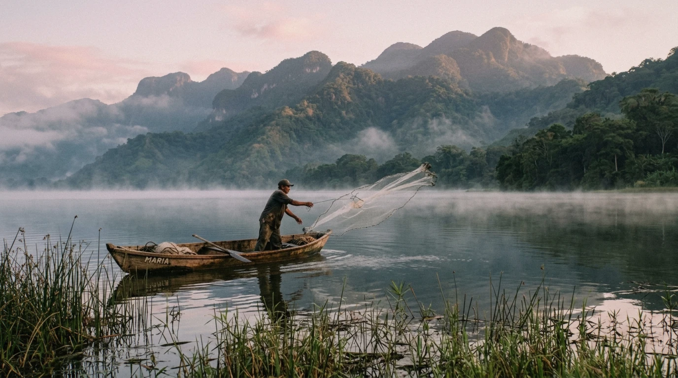
Lake Yojoa at first light.
Lake Yojoa Key Facts
These are the core figures for planning, drawn from official Ramsar and municipal sources plus well-cross-checked travel references.
The Numbers
The table below collects the figures most travellers ask about first: size, elevation, distance from San Pedro Sula and bird counts. Where sources disagree, both figures appear with a note, because they measure different points. Secondary figures are marked as such so you know which numbers are official and which are travel-guide estimates.
| Fact | Figure | Source |
|---|---|---|
| Surface area | About 79 km² (31 sq mi) | Wikipedia, reported |
| Elevation | About 700 m (2,300 ft) | Wikipedia, reported |
| Origin | Only lake in Honduras of volcanic origin | Ramsar |
| Ramsar listing | Site No. 1467, listed 2005, watershed 44,253.94 ha | Ramsar |
| Bird species | Nearly 400 documented in the watershed | Ramsar |
| Distance from San Pedro Sula to the lake | About 50.9 miles, roughly 1 hour 10 minutes by car | Rome2Rio, reported |
| Distance from San Pedro Sula to Santa Cruz de Yojoa town | About 72 miles | DistanceCalc, reported |
| Drive from lake to Pulhapanzak | About 30 minutes (about 15 minutes from D&D Brewery) | Secondary travel sources, reported |
Towns and Base
The lake sits beside the CA-5 highway, the main road between San Pedro Sula and Tegucigalpa, near La Guama on its eastern shore. Peña Blanca, about 2 km from the northern shore, is where most travellers base themselves. It holds the area's main cluster of eco-lodges, restaurants and guesthouses.
Santa Cruz de Yojoa is the municipal town on the north shore. In Aldea Los Naranjos on the lake itself, D&D Brewery, Lodge and Restaurant operates as Honduras's first microbrewery, with an open-air restaurant, cabins, private rooms and dorms. Roadside restaurants around the highway serve the local plate of fried whole fish with sliced plantains and pickled vegetables.
- Peña Blanca: the usual base, about 2 km from the shore
- La Guama: on the eastern edge beside the CA-5
- Santa Cruz de Yojoa: the municipal town on the north shore
- Aldea Los Naranjos: home to D&D Brewery and the eco-archaeological park
Things to Do at Lake Yojoa
The lake is a base for water, birds, fishing and two national parks. Here is what each involves and what it costs where a figure exists.
Kayaking and Boats
Kayaking is one of the standard ways to get on the water. Lakeside lodges run it, including D&D Brewery, which also operates a half-day morning birding tour by rowboat through the protected marshland, targeting aquatic birds and toucans for $24 per person. That price comes from the brewery's own site and carries no date, so treat it as approximate and confirm on arrival.
Beyond lodges, no published schedule of public boat rentals or lake crossings exists in the published sources, so plan water time through your accommodation.
| Activity | Price | Length | Booked Through |
|---|---|---|---|
| Half-day rowboat birding tour | $24 per person (approximate, undated) | Half day, morning | D&D Brewery |
| Kayaking | Not stated | Not stated | Lakeside lodges including D&D Brewery |
Birdwatching
This is the lake's headline claim. The Ramsar Convention documents nearly 400 bird species in the watershed, which the Ramsar site says holds 55% of Honduras's bird species. The protected area shelters 44.2% of the country's amphibian species and 43.6% of its reptile species across 16 ecosystems, including the critically endangered Dendrotriton sanctibarbarus salamander.
D&D Brewery's own marketing claims 485+ recorded species and calls the area one of the world's top birding sites. That is the brewery's own figure, not a neutral count, so use the Ramsar number of about 400 as the reliable one. eBird maintains active hotspot checklists for several sectors of the lake, including Lagolandia and the southeast tourist sector, useful for logging and checking live sightings.
- Nearly 400 documented species per Ramsar
- D&D Brewery claims 485+, a self-published figure
- The watershed holds 55% of Honduras's bird species
- eBird hotspots cover multiple lake sectors
Fishing and Bass Fishing
Lake Yojoa is a known bass-fishing destination. The most common catch is largemouth bass, alongside jaguar cichlid and fat snook. Fish typically run 1-5 lb, with occasional catches of 8-12 lb.
No official introduction date for black bass in the lake could be confirmed. No official fishing regulations are reported for the lake either, which is worth knowing before you plan a trip around it. No source in this research pass lists fishing guides or charter operators with prices, so arrange fishing through lodges and confirm current arrangements directly.
- Largemouth bass is the main target
- Also present: jaguar cichlid and fat snook
- Typical size 1-5 lb, occasional 8-12 lb
- No official fishing regulations are reported
Los Naranjos Eco-Archaeological Park
Los Naranjos sits on the lake's northern shore and pairs protected marshland with the remains of a pre-Columbian Lenca settlement. The site is Lenca, not Maya, which matters if you are chasing ruins specifically. A small museum and elevated wooden trail platforms through tropical forest complete the visit.
One thing to know before you go: no official, current fee or posted hours for the park could be confirmed from an authoritative source. One older secondary source says tickets are sold at D&D Brewery, but that could not be verified as current. Ask at your lodge before setting out.
- Lenca-era ruins, not Maya
- Small museum on site
- Elevated wooden trails through the marsh and forest
- Current fee and hours: no official source publishes them
The National Parks
Two protected areas flank the lake. Cerro Azul Meámbar National Park ( PANACAM ) covers about 314 km² on the eastern shore, rising from 415 m near the water to 2,047 m at its summit. It supplies more than 70% of the water flowing into the lake, has about 16 km of marked and maintained trails, and holds over 170 recorded bird species.
It was declared a national park in 1987. Santa Bárbara National Park borders the western side and contains Montaña de Santa Bárbara at 2,744 m, Honduras's second-highest peak. The cloud forest there is rich in orchids and epiphytes, shelters the salamander Dendrotriton sanctibarbarus and the endemic shrub Mahonia glauca, and quetzal sightings are reported on the mountainside.
| Park | Size | Elevation | Trails and Wildlife |
|---|---|---|---|
| Cerro Azul Meámbar (PANACAM) | About 314 km², eastern shore | 415 m to 2,047 m | 16 km of marked trails, 170+ bird species |
| Santa Bárbara | Western side of the lake | Peak 2,744 m, Honduras's second highest | Cloud forest, orchids, quetzals reported |
The Taulabe Caves
The Cuevas de Taulabé are the easiest cave visit in the lake area and slot well into a day that also includes the waterfall.
What You Will See
The caves are natural limestone formations extending more than 12 kilometers, discovered in 1969. The interior holds a constant temperature of about 22°C year round, which is a relief from the lake's heat. The first 300 meters are lit and walkable on a set path without a guide.
Beyond that point a guide is required. Guided tours run regularly through the day and last roughly 45 minutes to one hour, with the guide included in admission. The site sits about 15 minutes from downtown Taulabé and roughly 140 km north of Tegucigalpa.
Local lore recorded by the municipality holds that in 1972 a hijacker hid part of the ransom money from a Boeing 727 hijacking inside the caves.
Fees and Hours
No single authoritative current fee exists. Reported entrance figures vary by source: one gives 30 lempiras for adults and 10 for children, while another gives 100 lempiras for foreign visitors. The municipal site does not publish a fee table, so treat all of these as unverified approximations and carry cash in lempiras to cover the top of the range.
Hours are commonly reported as 8am-4pm daily, though this also comes from secondary sources rather than an official posting.
| Item | Reported Figure | Status |
|---|---|---|
| Adult entrance | L 30 to L 100 depending on source | Unverified, sources conflict |
| Child entrance | L 10 | Unverified |
| Guided tour | 45-60 minutes, guide included in admission | Reported by secondary sources |
| Hours | 8am-4pm daily | Commonly reported, not official |
Sources: Municipalidad de Taulabé, The Wanderlust Effect, International Parks
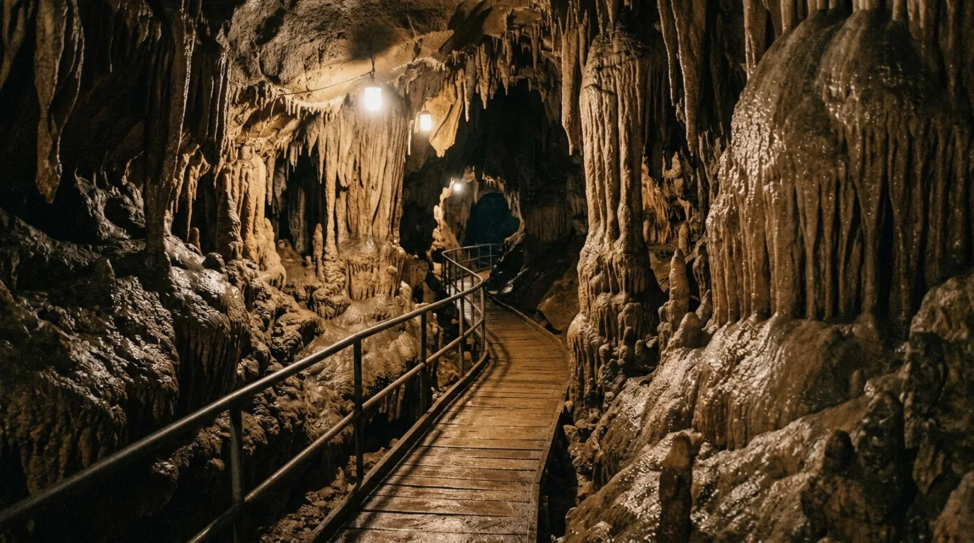
The Taulabe caves, on the road past the lake.
Getting to Lake Yojoa from San Pedro Sula
The lake is the closest major nature destination to San Pedro Sula, which is why it works as both a day trip and a highway stop.
Distance and Drive Time
The drive from San Pedro Sula to the lake area covers about 50.9 miles (roughly 82 km) and takes about 1 hour 10 minutes by car, a Rome2Rio estimate that does not factor traffic. Note that a second source measures about 72 miles to Santa Cruz de Yojoa, the municipal town on the north shore. The two figures are not contradictory, they simply measure to different points, so use the shorter one for the lake shore and the longer one for the town.
The lake sits directly beside the CA-5 highway, the same road used by buses and private transfers running between San Pedro Sula and Tegucigalpa. Pulhapanzak waterfall adds about 30 minutes beyond the lake, or about 15 minutes from D&D Brewery specifically.
| Leg | Distance | Time |
|---|---|---|
| San Pedro Sula to the lake shore | About 50.9 miles (82 km) | About 1 hour 10 minutes |
| San Pedro Sula to Santa Cruz de Yojoa town | About 72 miles | Not stated |
| Lake (D&D Brewery area) to Pulhapanzak | Not stated | About 15 minutes |
| Lake area to Pulhapanzak | Not stated | About 30 minutes |
The Guided Day Trip Route
The easiest way to see the lake without a rental car is the guided day described in full on our Lake Yojoa and Pulhapanzak day trip page. The route runs about 1.5 hours from San Pedro Sula to Pulhapanzak, then allows 2 hours at the waterfall, then 3 hours at the lake with kayaks, then an optional 1-hour lunch stop charged as an extra fee, then about 1.5 hours back. The whole day runs 10 hours with pickup at 12 San Pedro Sula hotels.
| Stage | Time |
|---|---|
| Drive to Pulhapanzak | About 1.5 hours |
| At the waterfall | 2 hours |
| At Lake Yojoa with kayaks | 3 hours |
| Optional lunch stop (extra fee) | 1 hour |
| Drive back | About 1.5 hours |
Swimming and Safety at the Lake
Swimming and safety questions about Lake Yojoa deserve straight answers, and some of those answers are that no official source addresses them.
Can You Swim in Lake Yojoa?
No official source states whether swimming in Lake Yojoa is permitted, prohibited, monitored or safe. No lifeguard provision, water quality report or designated swimming area for the lake itself appears in any authoritative source. If swimming matters to your trip, note that the nearby Pulhapanzak waterfall does have a documented swimming picture: a calmer upstream pool with a lifeguard reported, and no swimming under the main falls because of the force of the water.
For general city safety context before you travel, see the guide on whether San Pedro Sula is safe.
General Safety Around the Lake
No official source addresses crime, water safety or health advisories specific to the Lake Yojoa area in the material. What the sources do support is physical-safety guidance for the activities: the behind-the-falls tour at Pulhapanzak involves slippery rocks, strong spray and rope-assisted sections, with visitor accounts noting minimal formal safety oversight and one source advising against it for children, with minimum-age suggestions ranging from 14 and up in one source to a caution against under-16s in another. Wear closed-toe shoes, go with a guide for anything beyond the lit cave sections at Taulabé, and carry your passport on any guided tour since listings require it.
- Lake swimming status: no official source addresses it
- Behind-the-falls tour: physically demanding, slippery and soaking
- Caves beyond the first 300 m: guide required
- Guided tours: bring your passport, not a copy
The Lake Yojoa Day Trip from San Pedro Sula
One guided day covers the lake, the waterfall and the caves in a single 10-hour loop for $225 with hotel pickup at 12 San Pedro Sula hotels. It includes kayaking on the lake, two hours at Pulhapanzak and the Taulabe caves, with bottled water and an English or Spanish guide for a maximum of 10 people. It does not include meals, and the zipline ($30) and the walk behind the falls ($20) are paid extras on site. Bring your passport and a change of clothes. The listing is not suitable for pregnant travellers or people with back, heart or mobility problems. If you would rather spend the day at Maya ruins, compare it with the Copán day trips on the homepage.
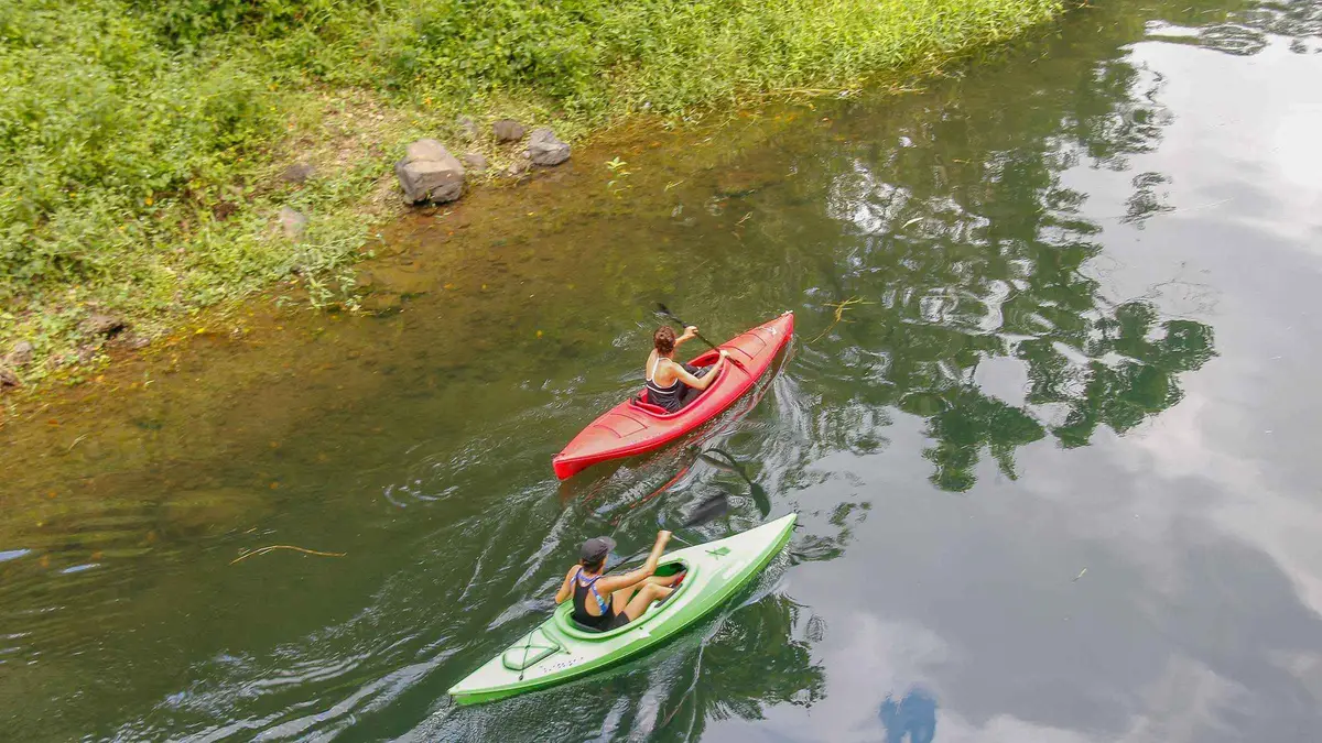
From San Pedro Sula: Yojoa Lake, Waterfall & Kayak Day Trip
Not a ruins day: two hours at Pulhapanzak waterfall, three hours on Lake Yojoa with kayaks, and the Taulabe caves, with hotel pickup and bottled water. The zipline ($30) and the walk behind the falls ($20) are paid extras, and meals are not included.
- Cancellation
- Free cancellation 24h
- Operator
- iCatracho Tours
Watch Before You Go
A third-party video, embedded from YouTube. We have no relationship with its creator.
Lake Yojoa: Questions
What makes Lake Yojoa special?
It is Honduras's largest natural lake and its only one of volcanic origin, a Ramsar wetland whose watershed holds nearly 400 documented bird species, 55% of the country's bird species, and two national parks on its shores. See the full facts in our Lake Yojoa guide.
Can you swim in Lake Yojoa?
No official source states whether swimming in the lake is permitted or safe. For documented swimming, the calmer upstream pool at Pulhapanzak waterfall has a lifeguard reported and no swimming under the main falls.
Are there any safety concerns at Lake Yojoa?
No official source addresses safety conditions specific to the lake. The main documented risks in the area are physical, on the demanding behind-the-falls tour and in the caves, so go guided and read our broader San Pedro Sula safety guide for city context.
What towns are near Lake Yojoa?
Peña Blanca, about 2 km from the northern shore, is the usual base. La Guama sits on the eastern edge beside the CA-5, and Santa Cruz de Yojoa is the municipal town on the north shore. The day trip from San Pedro Sula handles the drive for you.
How far is Lake Yojoa from San Pedro Sula?
About 50.9 miles (roughly 82 km) to the lake area, about 1 hour 10 minutes by car, or about 72 miles to the town of Santa Cruz de Yojoa. The guided day runs 10 hours door to door, details on the tour page.
Is Lake Yojoa good for fishing?
It is a known bass-fishing destination with largemouth bass, jaguar cichlid and fat snook, typically 1-5 lb and occasionally 8-12 lb. No official fishing regulations are reported. Fishing pairs well with a longer stay, so consider the lake as an overnight base.